in my last enty is talked about fiscially and government .
now , i will share about korea climate .
did you realize when you watch drama or movie korea ? they always show us about his climate when spring , summer , autumn , and winter ..
they show us how it look a like in their country ..
so , i will share about climate ..
hope you like it .

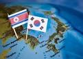
SOUTH KOREA CLIMATE
South Korea is a country located in East Asia, specifically
covering the southern part of the Korean Peninsula.
North Korea is the only country that borders with South
Korea, with a 238 km long border set by DMZ (Military Demarcation Line). Its
area mostly surrounded by water and has a long coastline of 2413 km. Bounded
west by the Yellow Sea, south of the East China Sea, while the east by the
waters of the Sea of Japan. Overall land area is 100,032 km ² and a wide
waters just 290 km ².

South Korea has many small islands off the coast waters. Is
the largest island of Jeju-do, located in the southern part of the peninsula
with an area of 1825 km ². Another important Ulleung Island in the Sea of
Japan and Ganghwa in the waters west. Although most of the coastal area has a
flat line, the southern and western coast berteluk-bay and have a vast muddy
plain.
The highest mountain in South Korea is Hallasan (1,950 m),
located on the island of Jeju. There are 3 major mountain range in South Korea,
the Taebaek, Sobaek and Jiri.
Only 30% of South Korea's land is low-lying, because most of
the land is upland and mountainous. Lowlands are mostly situated on the west
coast and in the valleys of the main rivers. Lowland plains important is the
Han River which includes Capital Seoul, Pyeongtaek plains on the west coast,
Valley Geum River, Nakdong River Valley, Yeongsan and Honam plains in the
southwest. Lowlands on the east coast narrower.
Nakdong River is the longest river, which is 521 km. Han
River that flows through Seoul length is 514 km. Another important river is the
Geum River, 401 km in length, the River Imjin and Bukhan that disgorge from
North Korea, as well as Seomjin River. The main large rivers flowing from north
to south or from east to west.
Climate
South Korea because it is located in a temperate region of
East Asia precipitation. The influence of air time over the plains of Asia to
the weather in South Korea compared to the influence of the Pacific Ocean. The
winter season lasts 3 months with dry weather conditions. While the short
summer, but very hot, wet and humid. Weather appears in the spring and autumn.
In the capital Seoul's average temperature in January is -5 ° C to -2.5 ° C; in
July ranged from 22.5 ° C to 25 ° C. Jeju Island is located in the most
southern part, received a warmer climate than the mainland, range from 2.5 ° C
in January and 25 ° C in July.
Although South Korea is less vulnerable to typhoons than
Japan, Taiwan, the east coast of China or the Philippines, the impact could be
huge. Each year there are 1 to 3 pieces of typhoon moving to the peninsula.
Typhoons usually strikes in late summer and bring a very high rainfall. Typhoon
triggered floods and landslides in various parts of South Korea.
One big typhoon to hit mainland Korea is Typhoon Prophet (Jolina)
on 8 September 2005 that killed eight people.
NORTH KOREA CLIMATE
North Korea is located in East Asia in the northern region
of the Korean Peninsula. North Korea's border with China, separated by the
River Amnok, Duman with Russia by River and South Korea by the Korean
Demilitarized Zone (DMZ). Yellow Sea in the west and the Sea of Japan in the
east.

Its area is 120.540 km ² which consists of 120.410 km ² land
and 130 km ² waters. Panjangperbatasan whole is 1673 km, with a length of 1416
km border with the People's Republic of China, 238 km with South Korea and 19
km with Russia.
North Korea has an uneven coastline (berteluk-bay) along
2495 km.
North Korea's extreme elevation point is as follows:
• The lowest point: Sea of Japan 0 m asl
• Highest point: Mount Baekdu (Paektusan) 2744 m
About 80 percent of the North Korean mainland are plateaus
and mountains and all points above 2000 meters in the peninsula in its
territory. The concentration of the population in low-lying areas.
Baekdu Mountain which is the highest point, is a volcano
with a crater the width of the border with the PRC. The series is composed
Hamgyong get to the east coast and have high peaks sepertiGunung Gwanmo (1756
m). Another series that make up the North Korean mainland include the Rangrim
Mountains that separate the lowlands in the west and east, on the border with
the Kangnam Series PRC, and Taebaek circuit that runs through South Korea. The
highest peak is Mount Kumgang series Taebaek (1638 m).
Lowland very small percentage. Pyongyang and Chaeryong
lowland in the west has an area of 500 sq km, while the east of the peninsula
more narrow.
Mountains in the north and western parts of North Korea is a
wellspring for important rivers, which flows to the west and east. To the west,
major rivers empties into the Korea Bay and the Yellow Sea. The longest river
is the Amnok River, limiting the area of the PRC and navigable along 678 from
790 km in length. Duman River is the longest river to flow-2 with 521 km to the
Sea of Japan. Duman River is only navigable along 85 km due to the
mountainous topography. Taedong River that flows through the city of Pyongyang
is 394 km in length is the longest river-3, flows into the Yellow Sea .
It`s the reason why them have a nice climate , as we wacth at drama or movie .
okey . thanks for visit my blogg .. :)